Hello CNU Medievalists! After working through June and July, Dyllan and I have finished our work on the Summer Scholars project. By the end we had translated 50 pages of the cartulary of the nuns of Saint-Amand. The final stages involved mapping the lands of the nunnery. We began with a map of the landholdings from the first part of the cartulary and the pancarte – these were all lands donated before 1071.
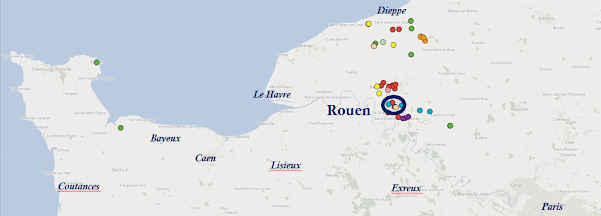
The date is significant because while the abbey was founded in the 1040s, the building of the church and monastic buildings was not completed until 1071. From this map we can see that the initial holdings of the abbey were in Rouen, in some areas to the east, and then to the north near Dieppe. This is likely due to Joscelin of Arques, who was a vicecomes in the area near Dieppe in the 1030s. Each color of dot represents a different donor; lands given by Joscelin and his wife Emmeline are in red, lands from Abbess Emma are in blue, and those from her brother Bishop Hugh of Bayeux are in purple. Royal donations from King William (the Conqueror) and Queen Matilda are in the gold colors.
From 1071 the abbey added lands and wealth, although typically from local individuals, rather than nobles or major ecclesiastics. The nuns concentrated on growing their holdings in five major areas: Rouen, Boos, Malaunay, Fresne-le-Plan and La Chausee (as shown below).
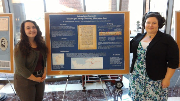
We brought our summer of work to an end with a poster presentation to the faculty of all colleges at CNU that took place just this morning as part of the Getting Started Week activities. There was an excellent reception from the faculty and we would like to thank everyone who came by and attended.


